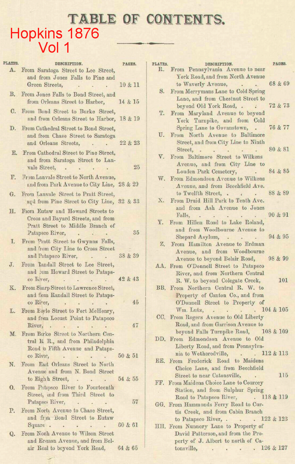
Hopkins Maps - 1876/1877This set of maps consists of two volumes: the first contains 34 images and is for the city and environs out to 5 miles. The second covers the county out to a distance of 10 miles and also contains 34 images. These maps show the property owner, the name of estate, location of buildings, railroads, businesses, etc.
Map index, Vol 1 (City and environs out to 5 miles) |