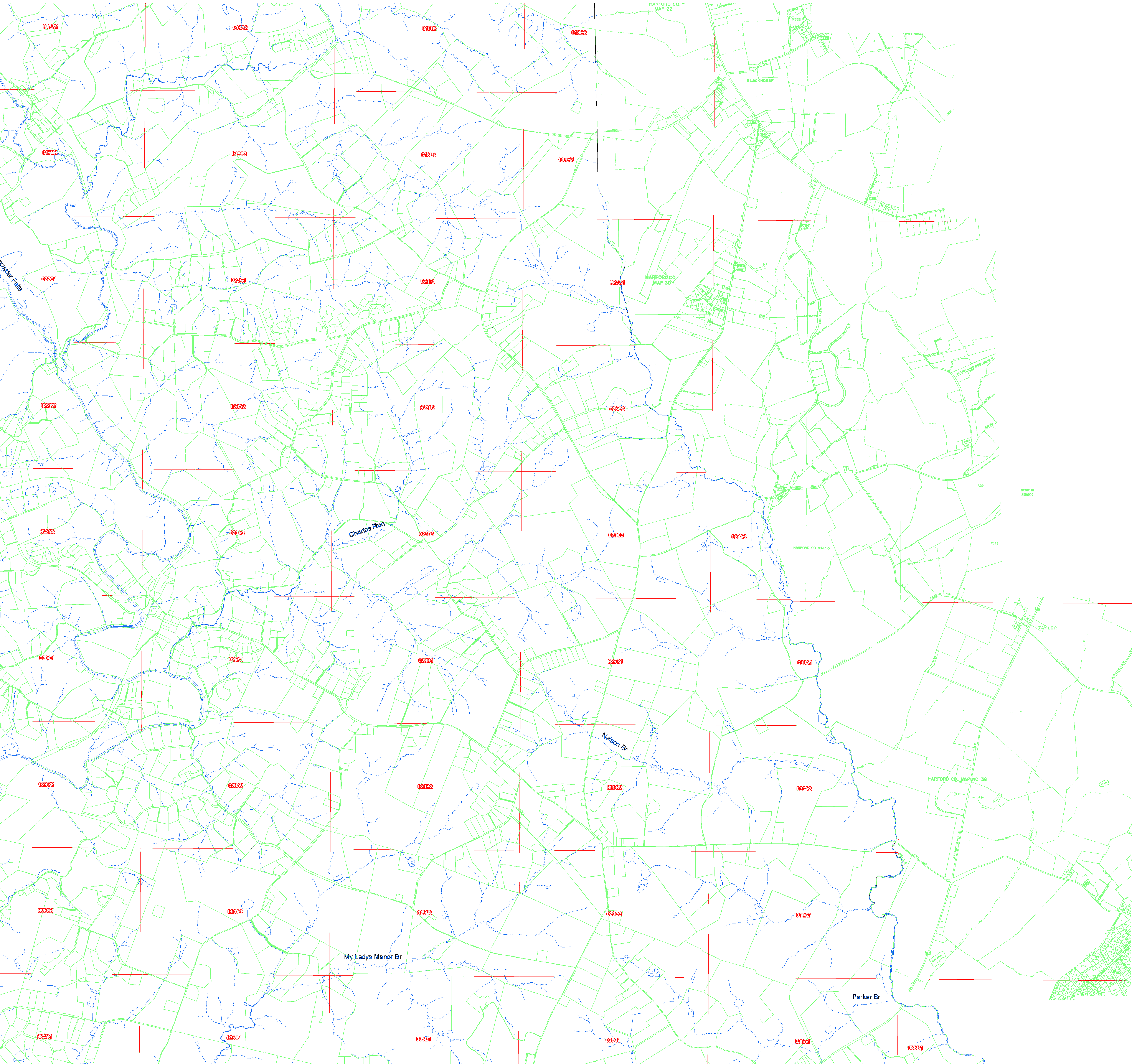
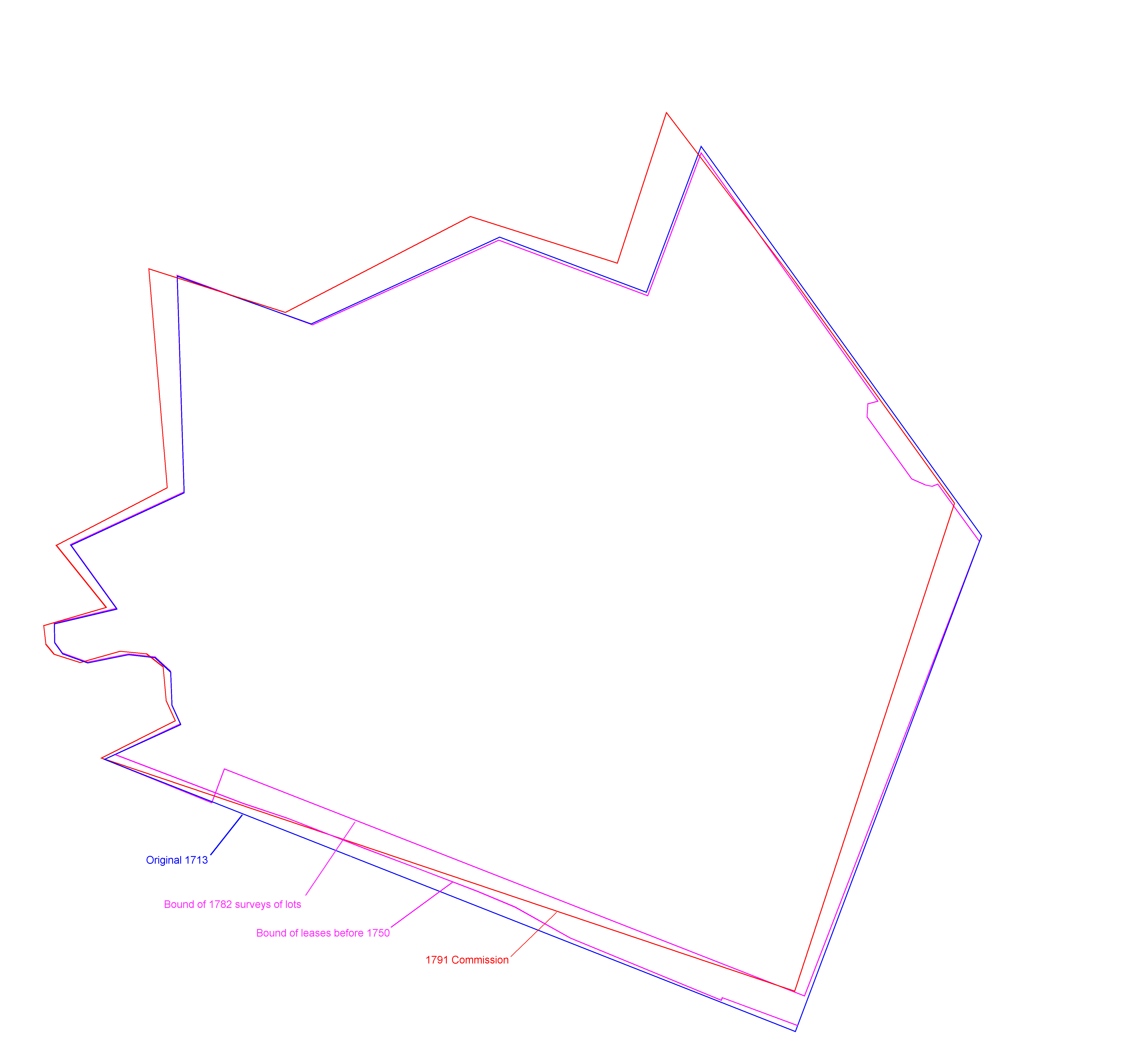
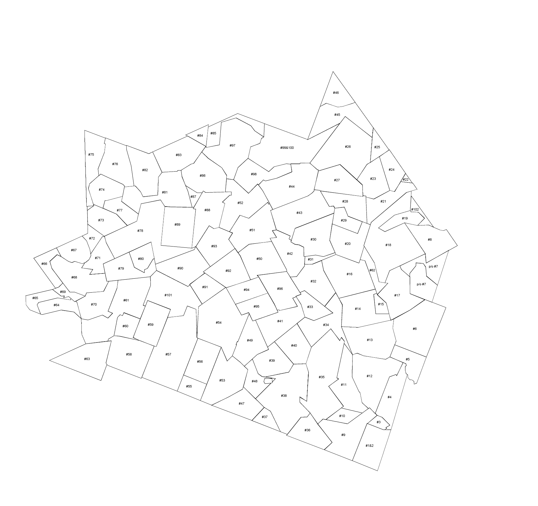
My Lady's Manor

This map allows one to view various parcels of leased and sold land over several periods of time, and depicts the boundary of The Manor as it was understood to be at those various times. Use the layer control box to turn on or off selected layers and the labels for the tracts.

Layer Control

Select which layers you wish to see:
Current properties:
(green backgound)
   (Always on)
 
MLM Surveys: Off On
Neighboring: Off On
Leases - pre-1750: Off On Labels
Leases - post-1750: Off On Labels
Lots (1782): Off On
Control + to zoom in
Control - to zoom out
Click on lot to display info.